Volume 2

place matters is an e-newsletter that shares news, perspectives, and progress from CDC/ATSDR’s Geospatial Research, Analysis, and Services Program (GRASP).

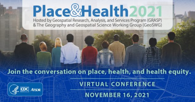
The Geospatial Research, Analysis, and Services Program (GRASP) and the Geography and Geospatial Science Working Group (GeoSWG) are proud to announce the Place & Health 2021 conference. The conference will take place virtually on Tuesday, November 16, 2021, from 8:30 a.m. to 4:30p.m. Eastern, and will feature a full day of presentations, posters, and lightning talks focused on the evolving role of geospatial science and technology in public health.
The conference is free and open to all Centers for Disease Control and Prevention (CDC) and Agency for Toxic Substances and Disease Registry (ATSDR) staff and the public. This year’s theme is health equity.
The keynote address will be delivered by Nancy Krieger, PhD. Dr. Krieger is a professor of Social Epidemiology, Department of Social and Behavioral Sciences, at the Harvard T.H. Chan School of Public Health, and Director of the Harvard School of Public Health Interdisciplinary Concentration on Women, Gender, and Health.
The conference will feature recorded opening remarks from CDC Director and ATSDR Administrator Dr. Rochelle Walensky, as well as the following speakers: National Center for Environmental Health and ATSDR Director Dr. Patrick Breysse, Agency for Toxic Substances and Disease Registry Associate Director Dr. Christopher Reh, and Department of Health and Human Services Advisor for Health Equity and Climate Arsenio Mataka.
To register for the conference and view the most current agenda, visit Place & Health 2021.

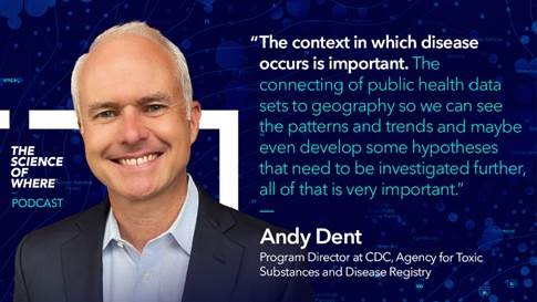
The places of our lives affect the quality of our health. Listen as GRASP Program Director Andy Dent is interviewed by Esri Chief Medical Officer and Health Solutions Director Dr. Este Geraghty. Dent and Geraghty discuss the important role of mapping, geospatial science, and how our homes, workplaces, schools, parks, and houses of worship impact our health. Listen to the podcast.

The U.S. Department of Health and Human Services Office of Minority Health has launched a new collaboration with GRASP called the Minority Health Social Vulnerability Index, known as the MH SVI. This newly customized version of the CDC/ATSDR Social Vulnerability Index applies a health equity lens to research, strategic planning, program design, and evaluation for response and recovery of disease outbreaks and other public health emergencies. Customizations include
- The addition of data on health care infrastructure and access
- An expansion of the Minority Status and Language theme to include data for five key racial and ethnic minority groups as well as the top five languages spoken by populations with limited English proficiency at the county level.
According to the Office of Minority Health, some of the uses for the new MH SVI include identifying communities of limited English-proficient individuals that may need assistance in other languages during outreach efforts and identifying medically under-resourced communities that need improved health care infrastructure and access.
This project illustrates how the CDC/ATSDR SVI can be customized and is the first of what is expected to be a series of collaborations between GRASP and the HHS Office of Minority Health.

Exposure to high levels of chemical contamination can cause various health outcomes. An example of chemical contamination is ethylene oxide (EtO), which can cause cancer and can also have noncancerous health effects. EtO is a chemical used to sterilize medical equipment and supplies in hospitals or sterilization facilities. Contact with EtO can occur from occupational or environmental exposure, primarily through the air.
To help health assessors understand the extent of exposure at various sites across the United States, ATSDR’s Office of Community Health and Hazard Assessment asked GRASP to assist with mapping and geospatial analysis of EtO-producing industrial plants. Since 2019, static maps, spoke custom base maps, polar plots, and other visualizations have informed numerous ATSDR investigations. Additionally, GRASP analysts have used satellite imagery to identify urban and rural sterilizer sites for use in future studies.
Detailed maps and analyses showed the relationship between the concentration of EtO in the air and proximity to the facilities. These maps are instrumental in communicating findings and visualizing the data to communities.
GRASP will continue to aid investigators at additional sites with visualizations and analysis as ATSDR’s scientific assessments continue.

In August of 2017, Hurricane Harvey struck the coast of Texas. The storm triggered an increase in emergency department visits in Houston and the greater Dallas-Fort Worth area. GRASP researchers and collaborators from the Center for Preparedness and Response’s Division of State and Local Readiness used the CDC/ATSDR Social Vulnerability Index to describe individuals seeking medical care because of the natural disaster. Findings included
- Individuals who sought care locally tended to be from lower-income communities with high poverty and unemployment, lower educational attainment, and more extensive impact from the storm. These individuals may be less likely to evacuate.
- Individuals who sought care farther from home may be older adults, may be more likely to have a disability, and may be from single-parent households, suggesting that evacuation and preparedness messages are working among this group.
- Health care providers could use this information to help plan for patient influx after a hurricane event.
- Health care providers in nearby but unaffected areas receiving evacuees may see more patients with disabilities and age-related vulnerabilities.
For more information:
Rickless D, Wilt G, Sharpe J, Molinari N, Stephens W, LeBlanc T. (2021). Social Vulnerability and Access of Local Medical Care During Hurricane Harvey: A Spatial Analysis. Disaster Medicine and Public Health Preparedness, 1-9.

GRASP team members apply their knowledge in geography, geospatial science, and geographic information systems as first and contributing authors in a variety of publications.
2021 Publications
Fletcher KM, Espey J, Grossman M, Sharpe JD, Curriero FC, Wilt GE, Sunshine G, Moreland A, Howard-Williams M, Ramos JG, Giuffrida D, García MC, Harnett WM, Foster S. Social vulnerability and county stay-at-home behavior during COVID-19 stay-at-home orders, United States, April 7–April 20, 2020. Ann Epidemiol. 2021 Sep 6:S1047-2797(21)00280-5.
Jones JM, Stone M, Sulaeman H, Fink RV, Dave H, Levy ME, Di Germanio, C, Green V, Notari E, Saa P, Biggerstaff BJ, Strauss D, Kessler D, Vassallo R, Reik R, Rossmann S, Destree M, Nguyen K, Sayers M, Lough C, Bougie DW, Ritter M, Latoni G, Weales B, Sime S, Gorlin J, Brown NE, Gould CV, Berney K*, Benoit TJ, Miller MJ, Freeman D, Kartik D, Fry AM, Azziz-Baumgartner E, Hall AJ, MacNeil A, Gundlapalli AV, Basavaraju SV, Gerber SI, Patton ME, Custer B, Williamson P, Simmons G, Thornburg NJ, Kleinman S, Stramer SL, Opsomer J, Busch MP. Estimated US Infection- and Vaccine-Induced SARS-CoV-2 Seroprevalence Based on Blood Donations, July 2020-May 2021. JAMA. 2021 Sep 2. doi: 10.1001/jama.2021.15161.
Troppy S, Wilt GE*, Whiteman A*, Hallisey E*, Crockett M, Sharpe JD*, Haney G, Cranston K, Klevens RM. Geographic Associations Between Social Factors and SARS-CoV-2 Testing Early in the COVID-19 Pandemic, February-June 2020, Massachusetts. Public Health Rep. 2021 Aug 13:333549211036750.
*Asterisk indicates GRASP author
Sign up to have place matters delivered to your mailbox:
Thank you for your interest in place matters. We want to hear from you. Your feedback is important to us. Let us know what you liked and what you’d like us to change, and your ideas for future newsletters. Send us an email at placeandhealth@cdc.gov.
We encourage you to share the newsletter with your networks. If you’ve received this newsletter from a colleague, please subscribe so we can send the next issue of place matters directly to your inbox.
Interested in learning more about GRASP? Email us at placeandhealth@cdc.gov.