How Does Place Affect Health?

Geospatial Determinants of Health
The places of our lives – our homes, workplaces, schools, parks, and houses of worship – affect the quality of our health and influence our experience with disease and well-being. Geospatial science, geographic information systems (GIS), and cartographic visualization provide important concepts, methods, and tools equipping public health scientists to examine, characterize, and analyze the important relationship between our health and the places of our lives.
As part of its work, GRASP has proposed and is shaping a framework, the Geospatial Determinants of Health (GDOH), that articulates the many and varied geospatial drivers that influence disease prevalence and promote health. The GDOH are at work in multiple environments where we experience health, including the natural environment, built environment, population connectivity environment, social and behavioral environment, and health policy environment. The emerging purpose of the GDOH is to (1) define the geospatial drivers of health with an emphasis on factors that vary by place, (2) serve as a catalyst to define, promote, and advance the use of place in research and practice across the public health community, (3) shape the public health curriculum of schools across the United States to advance geospatial analysis, statistics, and technology in the study of public health.
Natural Environment
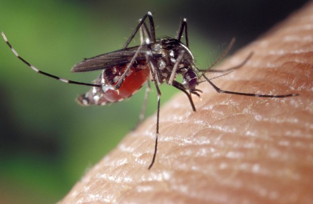
The natural environment is the setting where we live, and it includes the air, land, water, plants and animals around us. Environmental contamination, catastrophes, and naturally-occurring compounds have been linked to disease, injury, and complications of chronic conditions.
Built Environment
The built environment is the human-made or modified environment where we live. The built environment includes the buildings in which we work and learn, the parks in which we exercise, the roads and transportation systems we use to travel from place to place, as well as the water distribution systems, electrical grids, and mobile and broadband networks we use to access information and stay connected. Characteristics of the built environment may limit our access to healthcare, healthy food, clean water, and safe places for physical activity.
Population Connectivity Environment
The population connectivity environment includes characteristics of our environment, our settlements, our behavior, and our connections with people and animal populations that cause, intensify, or prolong the transmission of disease. These connections are driven by family and community relationships, commuting patterns, and domestic and international travel and commerce. Features of the population connectivity environment bind us together with both human and animal populations, and geospatial scientists can use geospatial technology and visualization to identify and examine these linkages.
Social and Behavioral Environment
Cultural traditions, shared values, beliefs, attitudes, and social institutions are passed down through history and connected to all aspects of a person’s life, including health outcomes. Each culture has a system of health beliefs which influence how they understand and seek out health information to make decisions. Cultural traditions, such as diet, behavior, and language can impact an individual’s health and health literacy. Geospatial scientists can use GIS and datasets, such as the U.S. Census and American Community Survey, to show us where different cultural groups live.
Health Policy Environment
Governments at all levels enact place-based policies that influence our access to health education programs, provide emergency services, regulate natural resources, decrease barriers to better health, and increase opportunities that may influence health behaviors. Social and economic policies that target housing, safety, employment, public transportation, and education can benefit physical and mental health outcomes for affected communities by increasing access to health services and improving an individual’s health literacy. Geospatial scientists can further examine the impacts of health outcomes with cartographic mapping and GIS analysis tools to improve population health.
A New Geospatial Lens in Public Health
Place is a broad and evolving concept, and the places of our lives define, shape, and influence the health determinants we face throughout our lifetimes. GRASP program scientists use geospatial concepts, methods and tools to examine the convergence of geospatial health determinants that vary by place. Working at the intersection of place and health to gain a better understanding of GDOH is key to promoting health, preventing disease, and creating government policies, processes, and procedures that advance public health.
Learn more about GRASP and their work in place and health.